Category: Tree Protection Bylaws & UFMP
-
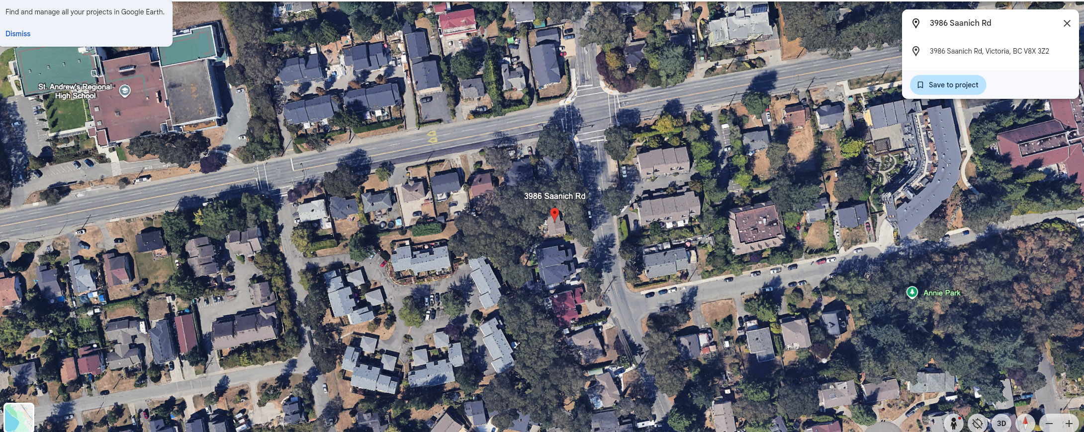
When Climate Action Loses the Plot: Saanich at McKenzie Roads and the Consequences of Not Thinking with Place
By Squirrel For Mayor At the March 17, 2026 Saanich Council decision approving a rezoning application and development permit for a six-storey condo proposed for the corner of 961 McKenzie and 3986, 3990 Saanich Road, the justification was familiar — and explicitly stated. Loss of Garry oaks, we were told, is the price of protecting Read more
-
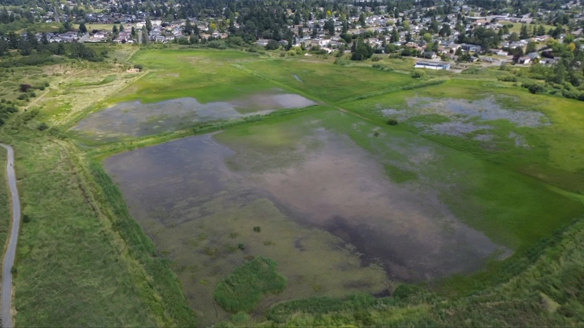
Saanich – Parts of Panama Flats to be designated as park to protect birds, off-limits for dogs
Times Colonist, October 22, 2025 by Michael John Lo Starting next year, staff is set to begin updating trails, fencing and signage in the area to create a dedicated area for migratory birds, waterfowl and rare plants.z Large parts of Panama Flats will eventually become off-limits to dogs, after Saanich council agreed to designate the Read more
-
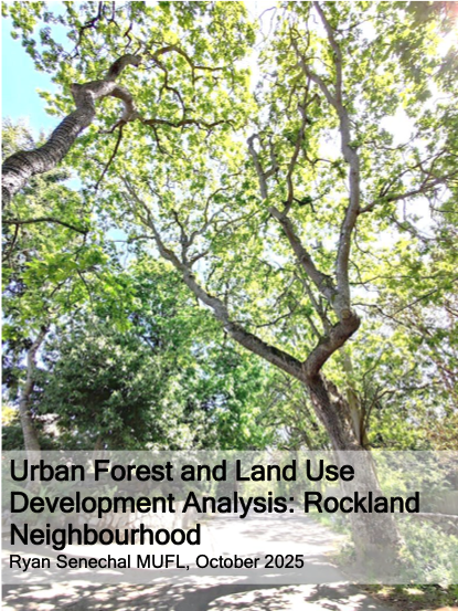
Urban Forest and Land Use Development Analysis: Rockland Neighbourhood Ryan Senechal MUFL, October 2025
AbstractThis report examines the relationship between urban forest canopy, land-use policy, and development pressures in the Rockland neighbourhood within the context of the City of Victoria’s 2025 Official Community Plan update and its 2050 urban forest canopy targets. Drawing on City datasets, LiDAR-based canopy analyses, tree inventory records, annual reports, and information obtained through Freedom Read more
-
The Inconvenient Garry Oak Ecosystem: Distinguishing Native Trees from House Plants through Victoria’s Draft OCP.
By Squirrel for Mayor August 26, 2025 The urban area of the City of Victoria is the Garry oak (Quercus garryana) ecosystem (GOE) – a fact often left out of discussions on the urban forest. GOE or Kwetlal food system in lək̓ʷəŋən language, have been shaped by Indigenous agroecological management for thousands of years. It Read more
-
Do Tree Protection Bylaws really “protect” the urban forest since the introduction of new housing regulations and legislation?
Tree Protection bylaws for the urban forest are municipal. Each municipality is slightly different, but they are all affected by provincial legislation. Citizens believe that these bylaws protect the urban forest. The word “protection” is in the name, so it’s a fair assumption, but it requires a deeper look. Let’s use the City of Victoria’s Read more
-
Council Member Motion – Urban Forest Canopy
Council Member MotionFor the Committee of the Whole Meeting of April 3rd, 2025 COTW Video segment:https://pub-victoria.escribemeetings.com/Meeting.aspx?Id=f613a2e9-ce96-43b6-aca8-b281afcdaf54&Agenda=Merged&lang=English&Item=23&Tab=attachments Motion (.pdf)https://pub-victoria.escribemeetings.com/filestream.ashx?DocumentId=101687 BACKGROUND: A significant value for Victorians is nature, our climate, our hills, our natural green areas, and our urban forest. Section 4, Blue Green Networks of the 2025 DRAFT OCP, includes a brief description of the City’s Read more
-
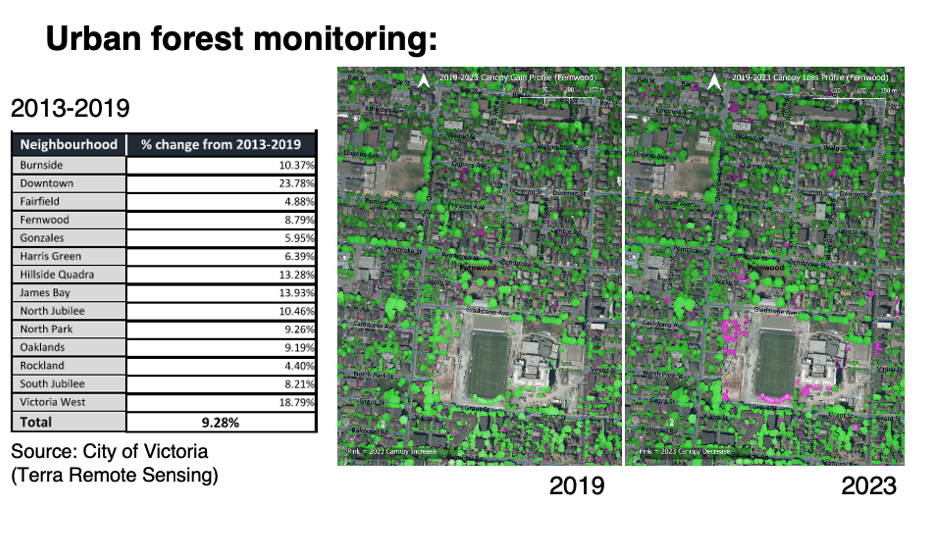
City of Victoria’s 2019-2023 LiDAR vegetation change detection analysis
City of Victoria Tree Canopy Using LiDAR data to Measure the City’s Tree Canopy. LiDAR (Light Detection and Ranging) technology uses laser pulses to create detailed 3D models of the environment. The City of Victoria’s Urban Forest Canopy Analysis from 2019 to 2023 was posted on Wednesday, April 02, 2025. Individual data points create point Read more
-
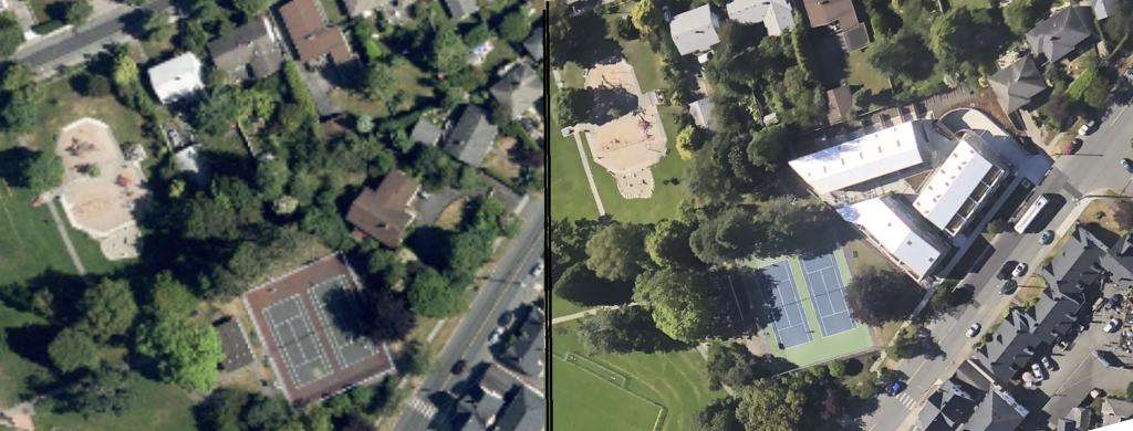
Presentation to Council- Urban Forest and Natural Assets, City of Victoria
Presentation: Thursday, March 13, 2025 at 6:30 P.M. Council Chambers E. Request to Address Council E.7 Urban Forest and Natural Assets (LiDAR) update for Draft OCP “Victoria 2050” Video Link: https://pub-victoria.escribemeetings.com/Meeting.aspx?Id=22a0de46-6b14-4887-83fe-114fa79ced8d&Agenda=Merged&lang=English&Item=29&Tab=attachments Documents: The City of Victoria has collected urban tree canopy data over multiple years by to perform ongoing measurements of its urban forest canopy. The City has outsourced urban tree canopy monitoring Read more
-
Dear Developer: Invitation template
Document published through the VCAN Community Mapping Project (Appendix “Dear Developer: Invitation template”) The scale of land use changes in the City of Victoria created a discussion by the VCAN Mapping Team on how start a conversation about the Garry oak ecosystem with market actors like builders and developers. The City of Victoria’s Tree Protection Read more
-
Open Letter to Matt Dell and City of Victoria Councillors about the Urban Forest
Dear Councillor Matt Dell, This letter serves as an open invitation for you to consider some of the unique community forest qualities in the territory that you now call home. The urban landscape of Victoria is characterized by Kwetlal, known also as the Garry oak ecosystem (GOE). This is a crucial detail often overlooked in Read more